In the past my good friend Dave Ridge and I made a point to get at least one winter backpacking trip in each year, and for several years had our annual “Piece o’ the AT Winter Hike.” For various reasons we hadn’t been able to do that for several years, so I was pumped when Dave called to invite me along with a couple of other guys for a 2-nighter – and the scheduled worked. This past weekend we hiked around 17 or 18 miles in the Smokies, including a great side-trip up Rocky Top.
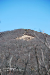
For our Winter Piece o’ the AT hikes we would select a route that included some part of the Appalachian Trail for a 2 or 3 night trip and invite a few friends along for what was usually from 12 to 28 miles of hiking and camping. In January Dave and I chatted back and forth about some routes (Dave always wants to get as much elevation as possible to decrease the temps and increase the chance of snow) and when he suggested the Cade’s Cove/Russell Field/Spence Field loop I jumped on it. I had done this route on our 2002 Winter Piece o’ the AT hike, one that Dave wasn’t able to make. Russell Field Shelter was closed that winter due to bear activity, so we spent the first night at Mollie’s Ridge that year, and the longer walk from Mollie’s Ridge to Spence Field precluded me from making any side trips that year. I did, however, spot the field shown in the intro photo and decided I’d come back someday and get up there. Since it’s around 3.1 miles from Russell Field Shelter to Spence Field Shelter and we were doing night one at Russell, this was the year.
Our hike was scheduled for Friday and Saturday nights, reservations were made for the shelters for our  group of 4. We headed out Thursday afternoon for a motel in Townsend to allow us to make an early, refreshed start from Cade’s Cove rather than starting after a 3+ hour drive. A heavy line of storms and high winds came through Tennessee that night, and we were worried about wet, windy weather for our hike in on Friday. However, this rainbow seemed to be an encouragement for us on Friday morning.
 Friday morning, so we made a lazy morning of it before heading into the Smokies. Turns out that report was true, with reports of 5 trees blocking the road. Our lazy morning timed the drive up into the Cove well, and we didn’t stop until just before reaching the picnic area, when we ran into the crew clearing the last of the blockages. We waited about 5 minutes for them to complete the job, and then followed them, arriving at the ranger station for check-in and parking around 9:30 AM.
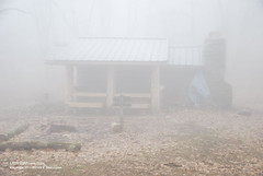
We quickly donned our gear, completed and deposited the backcountry permit, and headed for the Cade’s Cove picnic area where the Anthony Creek trailhead is located at the end of the picnic area, seeing a pileated woodpecker and a couple of sparring deer and the way. We walked the Anthony Creek Trail, slowly gaining elevation up to the Russell Field Trail. The Russell Field Trail gains a lot of elevation, with two fairly steep sections, one of which may have a gain of around 750′ in about 1/2 mile. After this climb and hard switchback (into the cold wind for us), the trail levels out for a while on Leadbetter Ridge. There is a view down into Cade’s Cove from here (at least in winter.) After this period of relief on the ridge the trail has a moderately steep climb to Russell Field. The trail drops off down to a creek crossing – the water supply for the shelter is just to the right – and then has a short, steep climb up to the shelter, a welcome sight after a strenuous 5.3 mile hike – even though the fog made it seem like a shadow at the top of the hill.
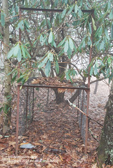
As noted above, the Russell Field Shelter was closed due to bear activity when I hiked here in 2002. I wonder if the nearby bear cage had anything to do with that incident. We didn’t see any bears, but really appreciated the cable system to hang our food, and the excellent update to the shelter which provides outdoors places to cook and eat. I was surprised to find that the shelter even has a fireplace, which was very nice to warm both the body and dry the shoes and socks.
We had the 14-capacity shelter to ourselves that night, so we were able to spread out nicely and got a good night’s sleep. With no TV to keep us up, 8 or 8:30 PM was bedtime, and I was up at 5 AM (inadvertantly awakening Dave) to make coffee and enjoy some star watching, watching the moon rise, watching Venus rise, and then watch the sunrise. Dave claims he was glad I woke him up.
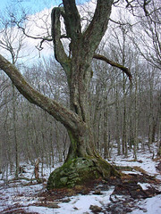
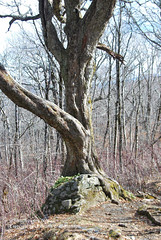
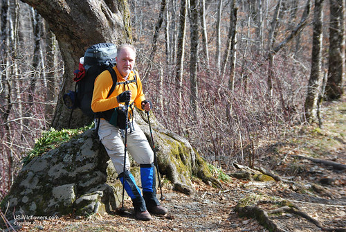
After a pretty leisurely morning we headed north on the Appalachian Trail toward Spence Field. The trail was steeper than I remember it as we climb from 4364′ at Russell Field Shelter to over 5000′ as we cross over Mt. Squires before dropping toward Spence Field. In this part of the trail there is an interesting tree that I photographed on the 2002 trip, so I had to photograph it on this trip, too. Note how little it has changed in the intervening 9 years.
It’s just a little over 3 miles from Russell Field Shelter to Spence Field Shelter, our destination for the day. Yes, I know, a lazy day – but remember, the objective is to get up to Rocky Top today, and also remember, plans don’t always work out exactly like expected. Stay tuned for part 2.

