
We usually just call it “Virgin Falls”, both to refer to the 1,551 acre plot of land, as well as the namesake waterfalls occupying the far end of it. The official name for the land, however, is ”Virgin Falls State Natural Area” at least since the state of Tennessee acquired it in 2012. When I visited it previously it was known as “Virgin Falls Pocket Wilderness” and was owned by the Bowater Southern Paper Corporation. Bowater owns and maintains a number of “Pocket Wilderness” areas, and admirable public benefit and, I’m sure, public relations activity. Tennessee acquired the land using a number of funding sources, including a grant from the federal Endangered Species Recovery Land Acquisition Fund. These funds were provided in part due to the presence of Virginia Spirea (Spiraea virginiana), one of the rarest shrubs in North America.
When I heard about Virginia Spirea being in the Virgin Falls area I decided I needed to add that to the USWildflowers Waterfalls and Wildflowers series, and I was fortunate to make an overnight hike into the Virgin Falls State Natural Area on March 8-9 of this year (2013). While many wildflowers were already in full swing down my way in north Georgia, 70 miles north and a bit of elevation gain makes a difference, and this will be more waterfalls and less wildflowers than I expected to report.
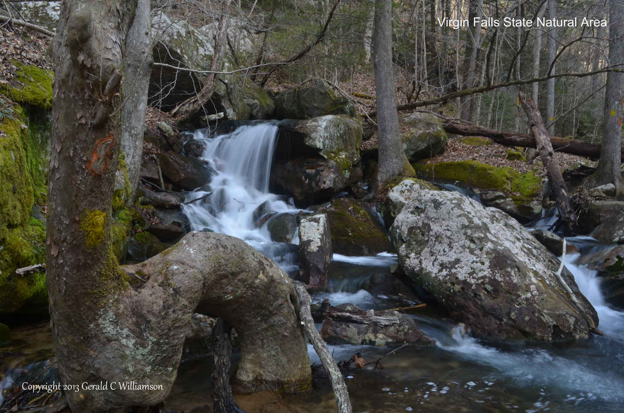
Cascade on Big Laurel Creek
Even so, there were wildflowers and signs of those to come, so I’m going to start out with the wildflowers. I was much too early for Virginia Spirea, and most of what were blooming (or nearly so) on my trip were down by Big Laurel Falls. This area will be wonderful very soon, as the Phacelia, Toothworts, Rue Anemone, Trout Lilies, and Trillium sessile add to the already-blooming Hepatica (var. obtusa) Virginia Spring Beauties, and Star Chickweed. New to me also was a Sedge, in blossom, which I think is Carex plantaginea.
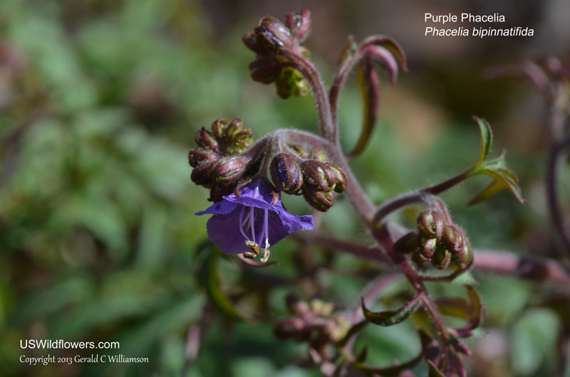
Purple Phacelia – Phacelia bipinnatifida – I found only a single blossom in many plants – they are ready to bloom!

Toothwort – I think this is Cardamine angustata. There were many blooming, peak will be soon.
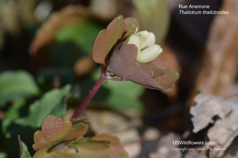
I found a single Rue Anemone starting to bloom – Thalictrum thalictroides
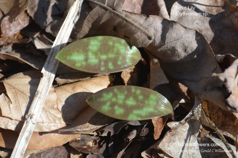
There were Trout Lily leaves all over the waterfalls basin – probably Erythronium americanum
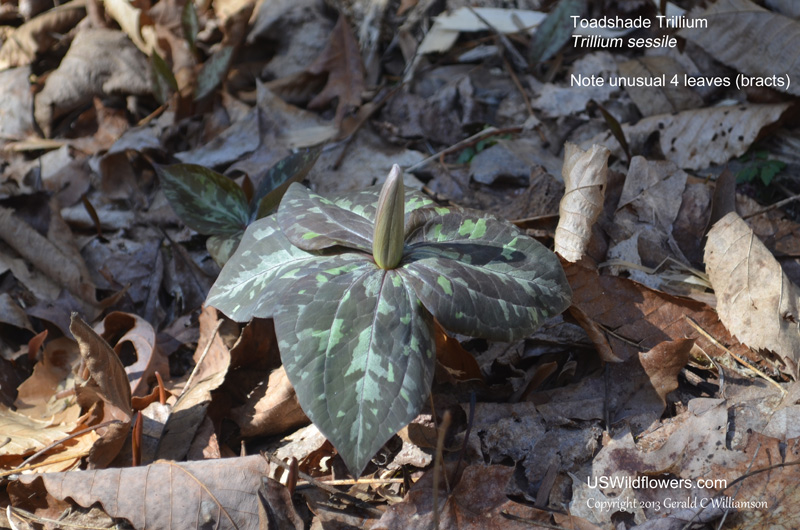
While not blooming yet, in the next few weeks Trillium sessile will be putting on a show. Note that this one is unusual in that it has 4 leaves.
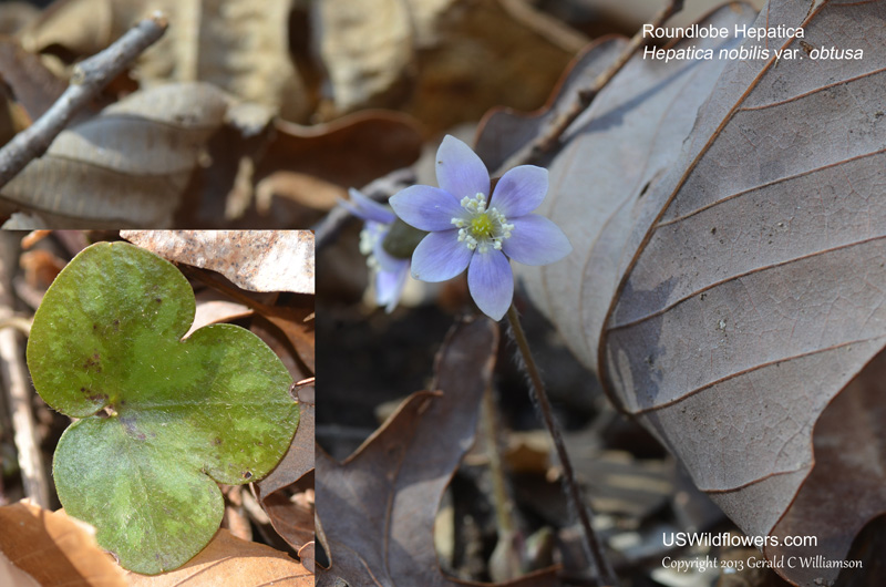
Hepatica was the primary flower blooming. In the vicinity of Big Laurel Falls all I saw were Roundlobe Hepatica – Hepatica nobilis var obtusa. Around Virgin Falls it was the sharp-lobed (var. acuta).
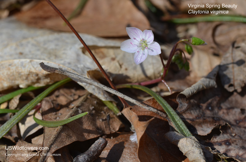
In number of plants blooming second only to the Hepatica were the Spring Beauties. All I saw were Virginia Spring Beauty – Claytonia virginica
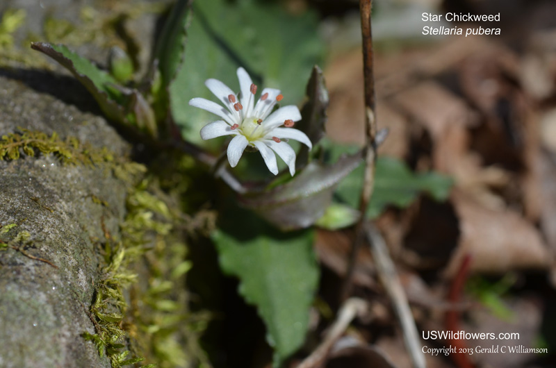
There were a number of Star Chickweed – Stellaria pubera
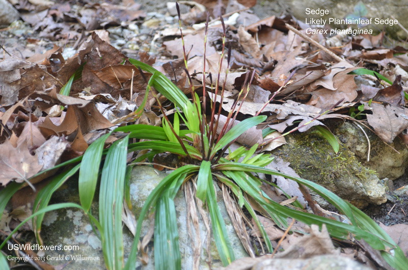
I think this is Plantainleaf Sedge – Carex plantaginea. This evergreen grew near and on the bluffs of around the falls.
Throughout the area I saw the leaves (and one standing stalk with seedpods) of Cranefly Orchid, and another orchid, Rattlesnake Plantain, will also be quite abundant in its season.
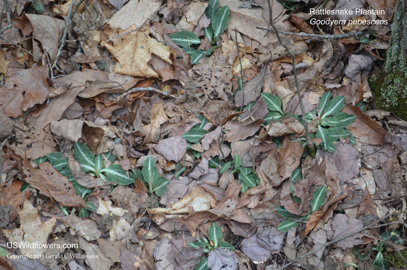
The basal leaves of Downy Rattlesnake Plantain- Goodyera pubescens were common.
The area of Virgin Falls itself didn’t have the abundance of wildflowers found at Big Laurel Falls, but there were plenty of Hepatica – this time var. acuta – all around the falls area, and also had plenty of Carex plantaginea.
That sounds like a good segue to the trail / falls part of the report. Be forewarned – this is a strenuous hike. The first mile of the trail is pretty level, meandering along Big Branch, crossing it a couple of times. The crossings weren’t difficult, but they would take some effort to keep your feet dry, especially with a full pack. Fortunately I was wearing my 8-inch waterproof Asolo boots, so I pretty much just slogged through. As you near a mile, however, you come to the warning that it’s going to start getting a bit rougher – the waterfalls start, the first one being Big Branch Falls, your entrance to the gorge.
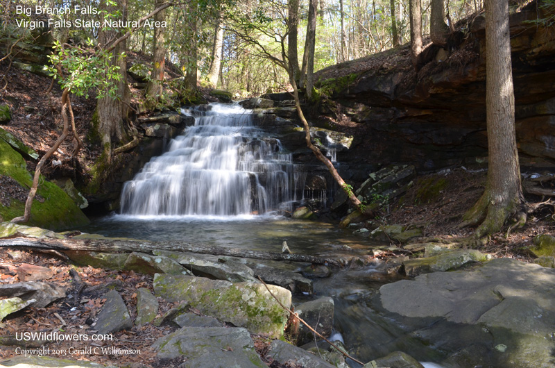
Big Branch Falls is 1 mile from the parking lot, and marks the real beginning of the descent into the gorge.
You start descending rapidly (remember, you’ll be ascending rapidly on your return) from there until you reach the cable crossing at Big Laurel Creek, a half mile further down the trail. This is another place where you might get your feet wet, and it could potentially be dangerous in very wet weather. Once again my 8-inch Asolo’s kept my feet dry as I crossed over to the campground located on the far side of the creek. I set up camp here – since I was carrying some camera equipment my pack was far heavier than what I wanted to carry back up out of the gorge.
After I set up camp I put my camera gear, water, a snack, and some emergency gear in my pack and headed on down the trail. The .5 mile trail up to Martha’s Pretty Point is just a short walk down the trail, and there is a designated campground at that location, but I didn’t walk it. Big Laurel Falls is only .8 miles further down the trail from the cable crossing, but that section of trail most of the elevation loss (gain on your return, remember that!) for the entire hike. It stays close to the creek, providing some great views of some cascades, and as you get to the point above Big Laurel Falls, you’re pretty high above it. We’ve had a pretty wet spring, so Big Laurel Falls was quite pretty, with good views of the falls from high above it, and all the way down to the campground in front of the falls.
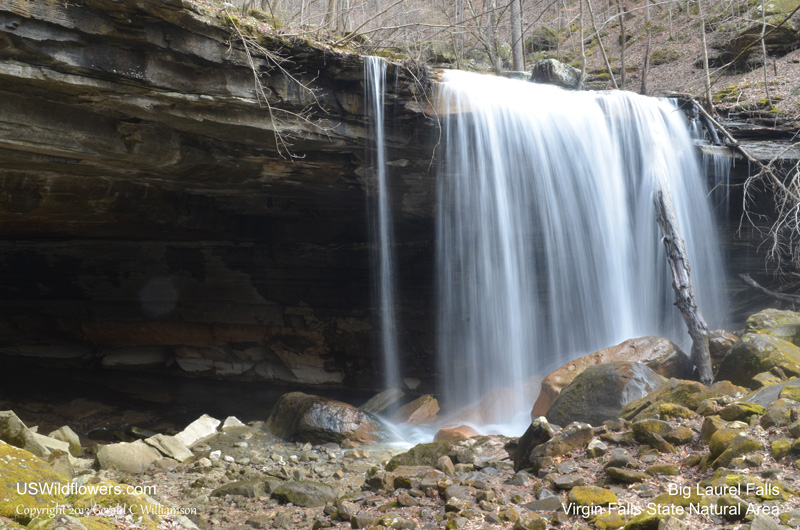
Big Laurel Falls from the campground in front of it.
There is a “cave” under the falls – perhaps more of a very deep overhang rather than a cave. The water from the falls runs into the back of this overhang and drops into holes in the ground, not to be seen again, at least not on this hike.

Looking out from the “cave” – a deep undercut. A fire ring and bench have been placed inside. The water flows into the cave and down into holes. The creek goes underground.
I returned to the cable crossing campsite for the night, returning to Big Laurel Falls the next morning. As you continue on down the trail toward Virgin Falls from Big Laurel Falls, you have a moderate uphill for a ways, and then for more than a mile the trail more or less stays on the same contour. You’ll need to make a decision at the trail junction, marked by a rock cairn when I was there – the longer Sheep Cave route, which again mostly follows the same contour except for a brief drop across a ravine just past Sheep Cave, or the shorter route to Virgin Falls? The shorter route also is steeper, all the way down to the Caney Fork River flood plain and then back up about 100′ elevation increase to the fall. My knees hurt, and I wanted to see Sheep Cave; easy decision. Also a good decision. Sheep Cave and its multi-drop falls is a wonderful place to visit.
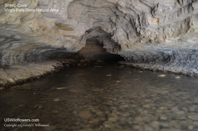
Looking into Sheep Cave.
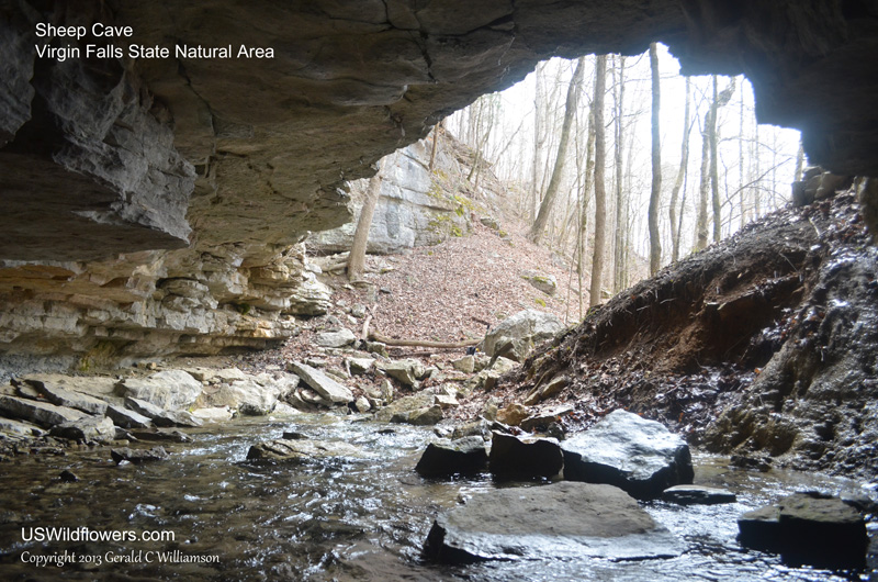
Looking out of the Sheep Cave entrance. The water takes a right, and goes about 20′, and drops off the upper falls.
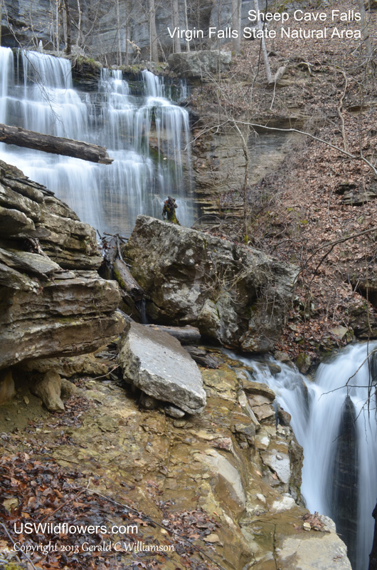
Upper Sheep Cave Falls. In the lower right is a middle falls.
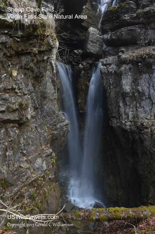
Lower Sheep Cave Falls. Near the top right corner is that middle falls shown in the prior picture.
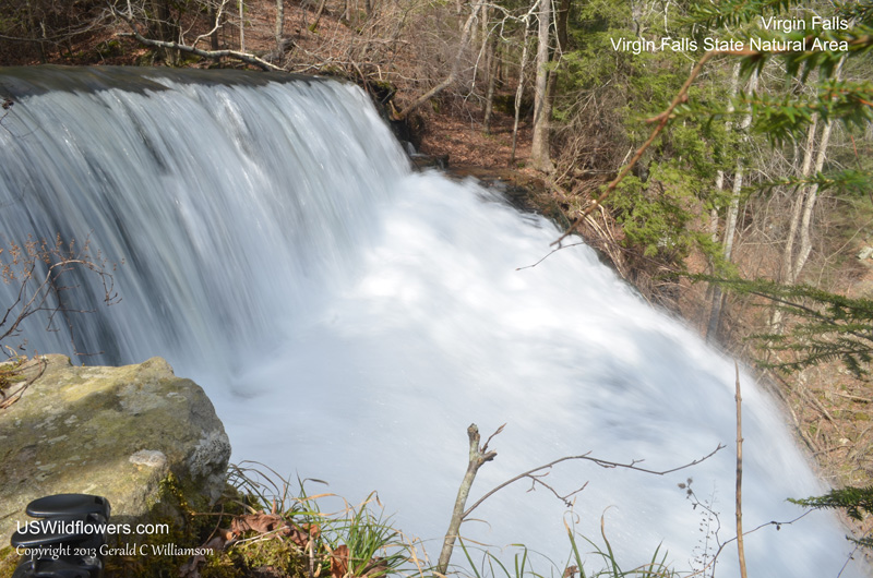
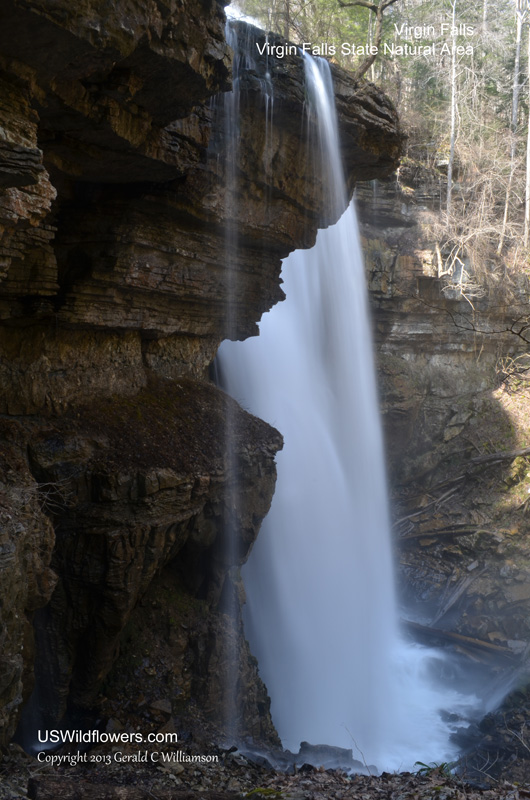
The walk on to Virgin Falls was a pleasant one, and gets to the falls through the campground area. I was surprised by the amount of water coming over the falls, even with the wet spring. It must have been a drier time of year the only other time I’d been there, about 15 years ago. Like Sheep Cave, the water comes out of a large cave entrance, has a longer run than Sheep Cave, then drops over a large falls, and then runs back into a lower cave.
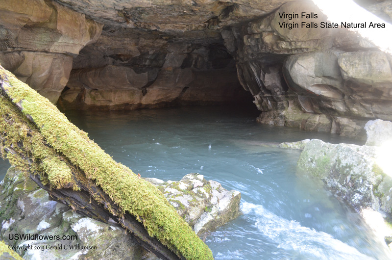
The water for Virgin Falls, like that of Sheep Cave Falls, comes out of a cave.
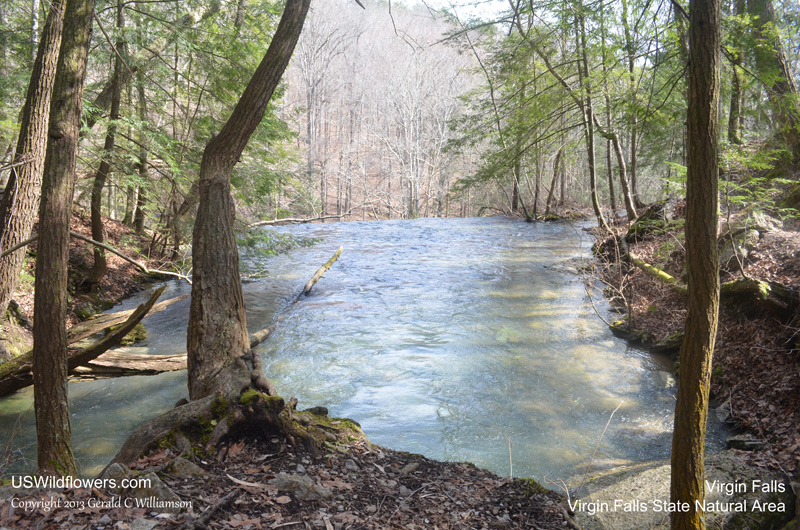
The creek exits the cave, passes under a natural bridge, then runs maybe 100′ before dropping into the sinkhole.
The is a small cascade at the top of Virgin Falls before the big drop.
The main falls, side view.
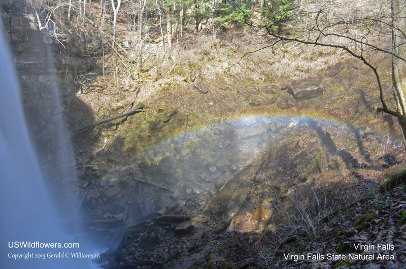
The mist causes a rainbow when the sun is shining
Time to pack up and head out for the 4 mile uphill trip back to the parking lot. But one last look back before heading out.
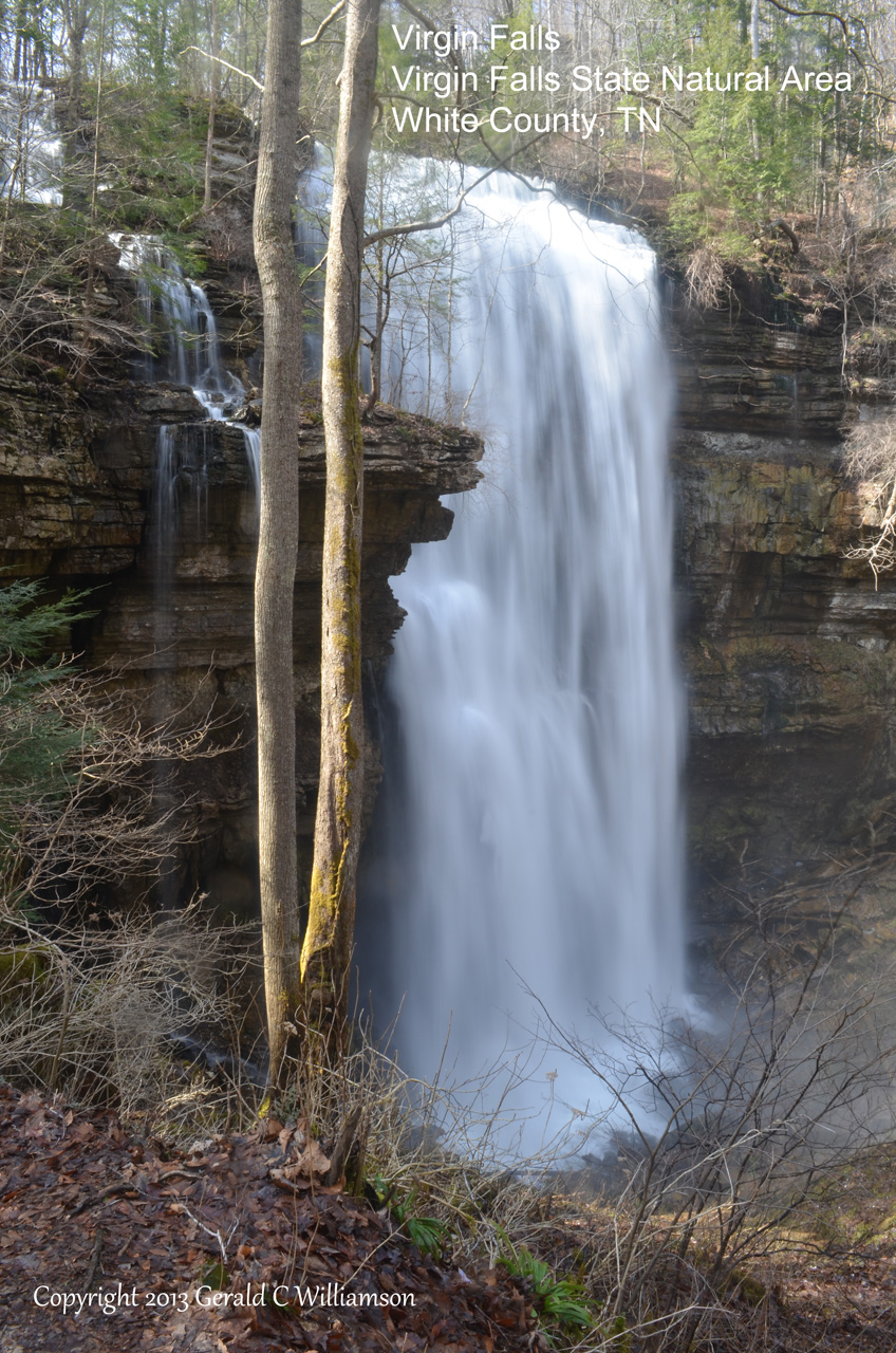
Virgin Falls drops into the sinkhole and runs into a cave behind the falls, going underground.
You have no idea how much I enjoy your blog and photos! Thank you for sharing!
Thank you very much for that encouragement, Leslie!