I’ve posted most of these photos on Facebook and Twitter already, but in my semi-retirement I am more and more using the Journal to try to track some of my activities – Cindy and I are finding ourselves asking each other “What did we do last week?” Some of those Journal entries are just private notes as to what we did, but some, like this one, might have some community interest. This is one of those.
Since I work part-time now, my weekend usually starts on Thursday afternoon, but this week some projects used more of my time earlier in the week so I finished up a couple of hours earlier than usual. We’d had rain (lots of rain) for 9 days in a row, and there was slight break in the rain before a cold front came through bringing more rain and possibly snow (some nearby areas got some; we didn’t.) I decided to take that break as an opportunity to run up to Cloudland Canyon State Park to see what the waterfalls looked like after all the rain.
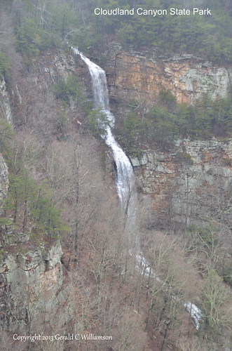
The first waterfalls that I saw wasn’t one that I expected. During normal water levels you don’t even notice this one across the canyon from the main overlook. I suspect that during dry weather there may be no water at all in this unnamed stream tumbling down the bluff.
It was wet and cold with a lot of mist, so I grabbed waterproof covers for my camera/lens and my rain jacket and pants, and headed quickly down the trail. It was clearly obvious how high the water levels were, even from the top. Normally you don’t see the falls from high up on the trail except for an occasional glimpse. At these water levels the locations of the falls were quite obvious. The trail was wet and I dodged the dripping water from the cliffs above as I walked quickly down the trail. The wind was pretty high at the upper elevations of the trail, and a number of branches, some large enough to be painful or perhaps dangerous fell nearby as I walked. However, as I walked down nearer the falls the gorge provided protection from the breeze and perhap some thermal mass from the water made the temperature perceptably more comfortable.
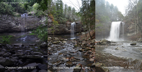
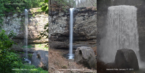
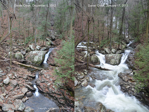
Here are a couple of photos comparing the water levels of the upper (Cherokee) and lower (Hemlock) falls on Daniel creek, and the creek below Hemlock Falls.
As I was making that last photograph on the right, above, it started to sprinkle again. I wrapped everything up and headed as quickly as I could make the steep climb out of the gorge. The wind started picking up and I heard the gunshot-noise of a tree going down somewhere nearby. By the time I reached the top it was a steady rain. Since I was walking briskly (relatively speaking) uphill, I didn’t bother putting on my raingear, so by the time I reached the car I was pretty well soaked to the skin. I realized, however, that I really enjoyed that walk. What a frame of mind cabin fever (9 days of rain!) will put you in.


Wow, what a difference the rainfall has made to the volume of water coming over these falls!
Certainly does, Mia. I didn’t really know what to expect, but I was surprised.